


Product Information
Description
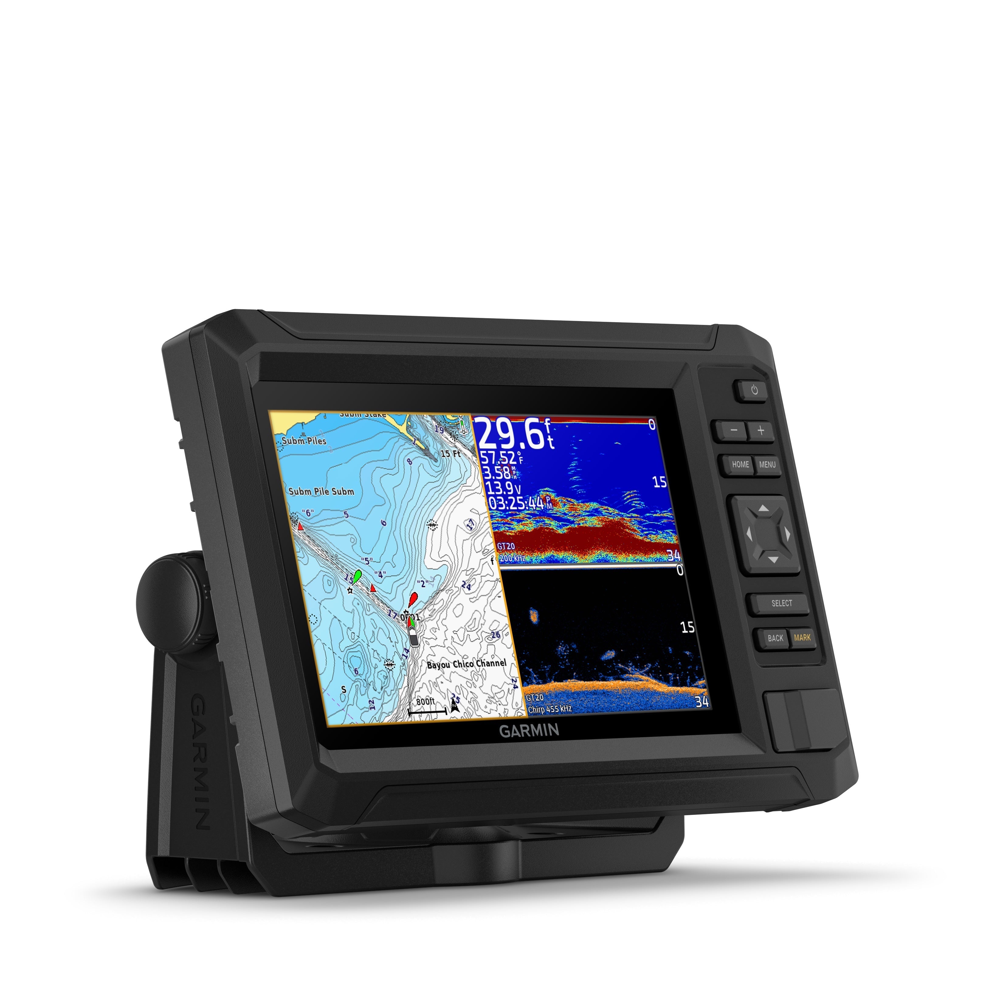
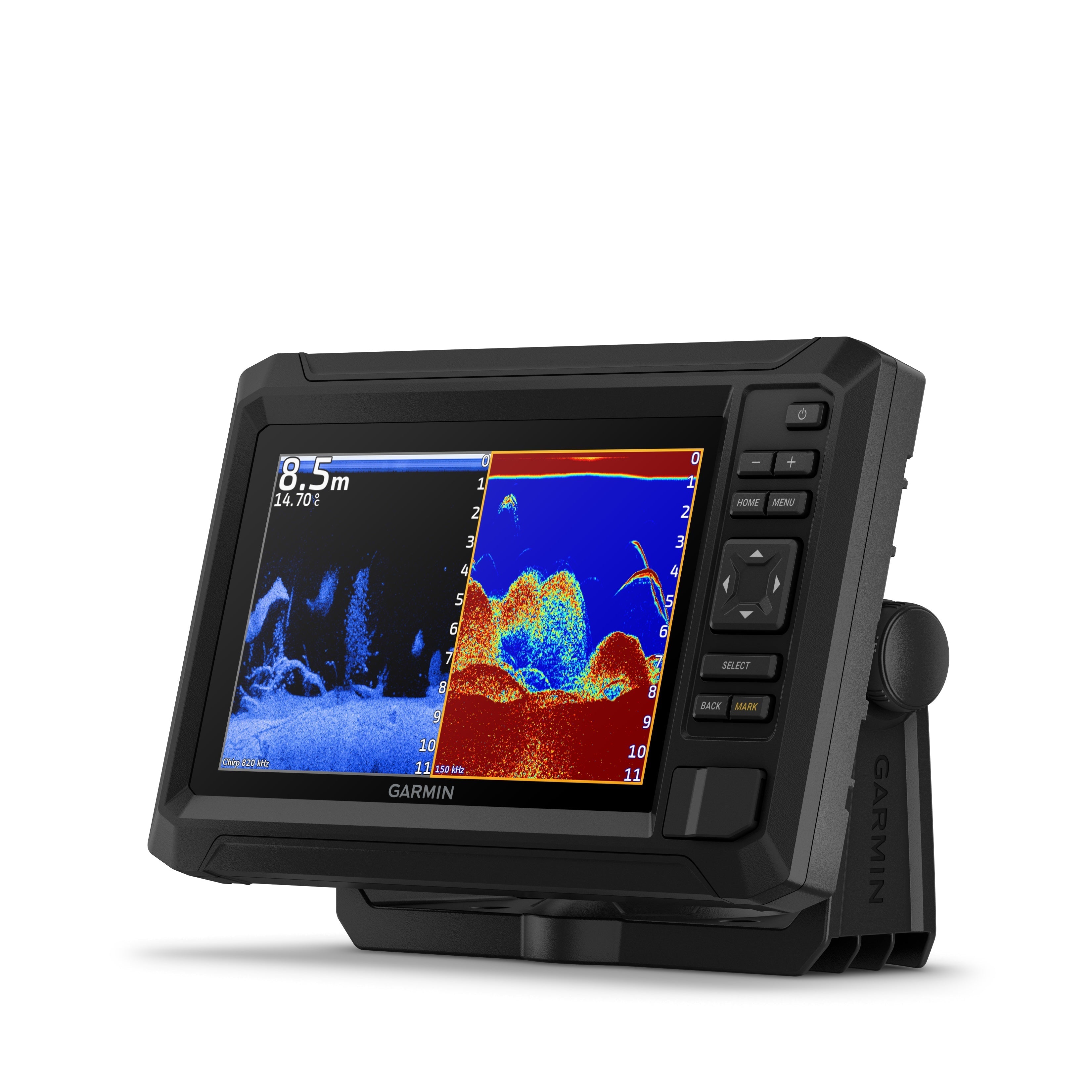
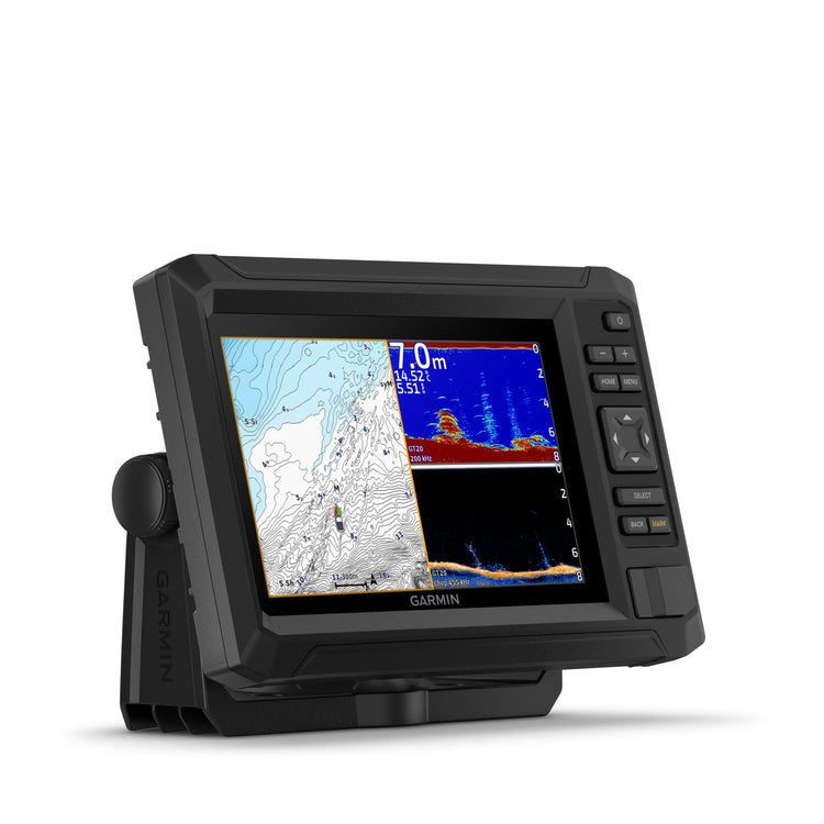
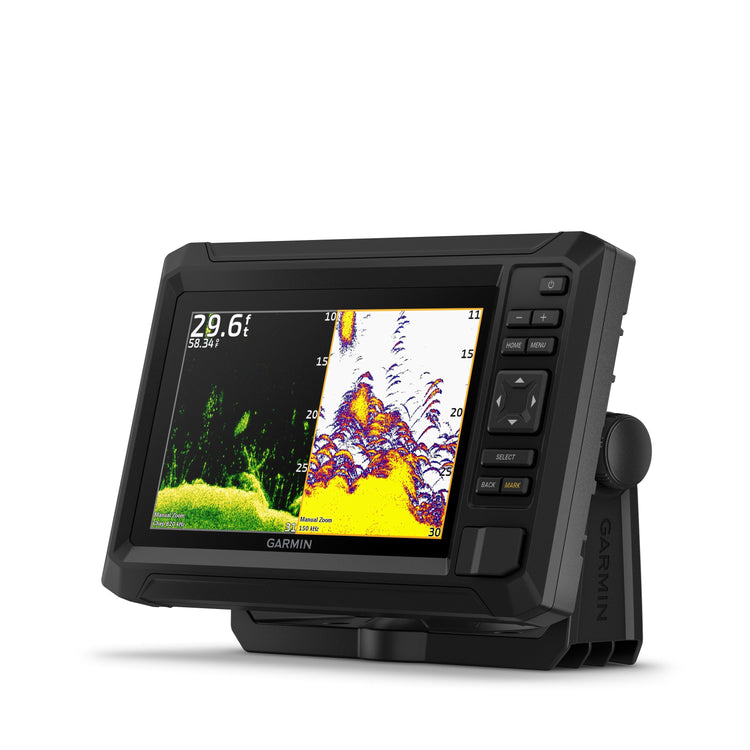
Fish like a local with the 7” ECHOMAP UHD2 chartplotter. See clear, sharp fish arches with Garmin traditional sonar. Use ClearVü™scanning sonar featuring vivid color palettes for clear, high-contrast views below your boat. Know the waters you’re in as if you grew up fishing them by using built-in LakeVü™ g3 inland maps or BlueChart® g3 coastal charts. It also supports Garmin Navionics+™ and Garmin Navionics Vision+™ marine cartography. Use built-in Wi-Fi® connectivity to share sonar, waypoints and routes with another compatible Garmin chartplotter. You can also pair with the free all-in-one ActiveCaptain® app on a compatible smartphone for access to the OneChart™ feature, software updates and more.
Benefits
Tech specs
Box Contents
Benefits
- The bright 7” keyed display is made for convenience
- Get double the views with Garmin CHIRP traditional and ClearVü scanning sonars
- What’s under the water looks even better with high-contrast vivid color palettes
- Wi-Fi® connectivity between compatible chartplotters makes it easy to share info
- Enjoy No. 1 in mapping with Garmin Navionics+ inland and coastal content
Tech specs
- Display Size: 7" diagonal; 6.1" x 3.4" (15.5 x 8.7 cm)
- Display Type: WVGA, TN
- Display resolution: 800 x 480 pixels
- Power Input: 9V to 18V DC
- Receiver: 5 Hz
- Waterproof: IPX7
- GPS: Yes
- Mounting Options: Bail or flush
- External memory storage: 1 microSD™ card slot; 32 GB maximum size (not included)
- Garmin Navionics+ (coastal): 74cv U.S., 75cv U.K./Ireland
- Garmin Navionics+ (inland): 73cv U.S. lakes
- Tide tables: 53cv, 54cv, 55cv, 73cv, 74cv, 75cv
Box Contents
- 1 x 7" ECHOMAP UHD2 Fishfinder
- 1 x GT20-TM transducer
- 1 x Power/data cable
- 1 x Tilt mount
- 1 x Flush mount
- Hardware
- Documentation
Description
Fish like a local with the 7” ECHOMAP UHD2 chartplotter. See clear, sharp fish arches with Garmin traditional sonar. Use ClearVü™scanning sonar featuring vivid color palettes for clear, high-contrast views below your boat. Know the waters you’re in as if you grew up fishing them by using built-in LakeVü™ g3 inland maps or BlueChart® g3 coastal charts. It also supports Garmin Navionics+™ and Garmin Navionics Vision+™ marine cartography. Use built-in Wi-Fi® connectivity to share sonar, waypoints and routes with another compatible Garmin chartplotter. You can also pair with the free all-in-one ActiveCaptain® app on a compatible smartphone for access to the OneChart™ feature, software updates and more.
Benefits
Tech specs
Box Contents
Benefits
- The bright 7” keyed display is made for convenience
- Get double the views with Garmin CHIRP traditional and ClearVü scanning sonars
- What’s under the water looks even better with high-contrast vivid color palettes
- Wi-Fi® connectivity between compatible chartplotters makes it easy to share info
- Enjoy No. 1 in mapping with Garmin Navionics+ inland and coastal content
Tech specs
- Display Size: 7" diagonal; 6.1" x 3.4" (15.5 x 8.7 cm)
- Display Type: WVGA, TN
- Display resolution: 800 x 480 pixels
- Power Input: 9V to 18V DC
- Receiver: 5 Hz
- Waterproof: IPX7
- GPS: Yes
- Mounting Options: Bail or flush
- External memory storage: 1 microSD™ card slot; 32 GB maximum size (not included)
- Garmin Navionics+ (coastal): 74cv U.S., 75cv U.K./Ireland
- Garmin Navionics+ (inland): 73cv U.S. lakes
- Tide tables: 53cv, 54cv, 55cv, 73cv, 74cv, 75cv
Box Contents
- 1 x 7" ECHOMAP UHD2 Fishfinder
- 1 x GT20-TM transducer
- 1 x Power/data cable
- 1 x Tilt mount
- 1 x Flush mount
- Hardware
- Documentation